Himalayan hazards of glacial lakes, cloudbursts, avalanches and subsidence
- Syllabus
- Disaster and disaster management
- As of
- October 2026
- glacial lake outburst flood
- moraine dammed lake
- National GLOF Risk Mitigation Programme
- cascading hazard
- cloudburst
- avalanche forecasting
- Defence Geoinformatics Research Establishment
- land subsidence
- Joshimath
- carrying capacity
- Mishra Committee
- Kedarnath 2013
- Chamoli 2021
- South Lhonak 2023
The first principle
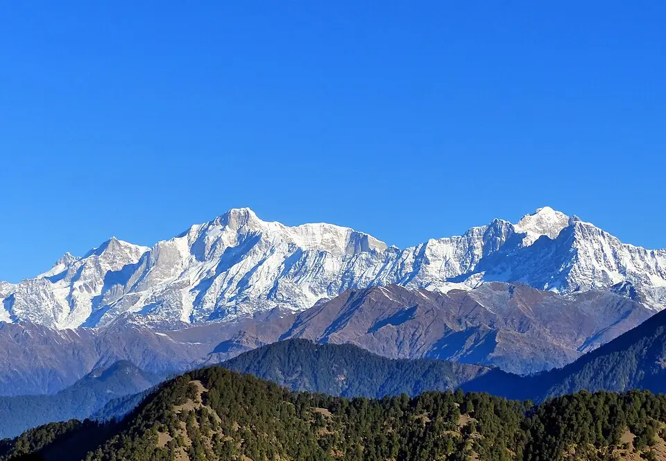
The Himalaya is a young mountain range that is still rising, so its slopes are steep, its rocks are broken and its valleys are narrow. Water, ice and loose rock are held on these slopes by a fragile balance, and when that balance breaks, one hazard sets off the next: a rockfall into a lake becomes a flood, the flood becomes a debris flow, and the debris flow destroys a dam far downstream. Managing Himalayan hazards therefore means managing chains, not single events, and the most useful decisions are about where to build and how much.
The core
Glacial lake outburst floods
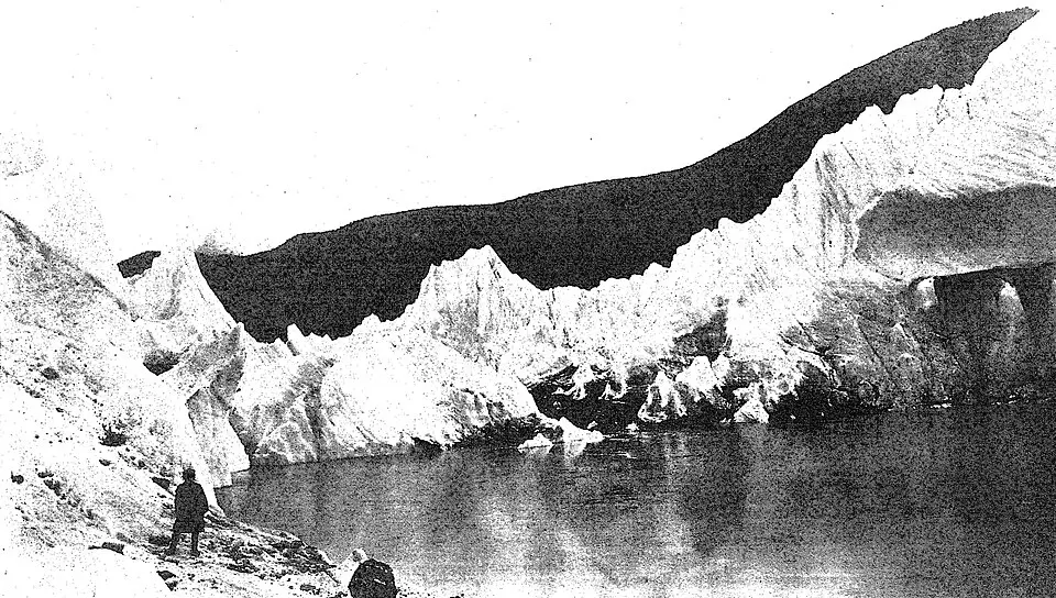
- How the lakes form. As glaciers retreat, meltwater collects behind the ridge of boulders, gravel and sand that the glacier pushed ahead of it, called a moraine. These moraine dammed lakes grow as warming continues, and some hold buried ice that slowly thaws and weakens the dam.
- How they burst. A glacial lake outburst flood (GLOF) begins when a trigger breaks the natural dam: rock, ice or moraine falling into the lake raises a wave that overtops it, or heavy rain, an earthquake or seepage cuts through it. Millions of cubic metres of water leave within hours, pick up sediment and boulders, and strike valleys tens of kilometres away with little warning.
- Why it matters for management. The lakes lie in remote, high terrain that people rarely visit, so monitoring has to rely on satellites and automatic sensors, and warning must travel faster than the flood. The physical side of glacier retreat is covered in the GS1 note on the changing cryosphere.
Cloudbursts, avalanches and subsidence
- Cloudburst. The India Meteorological Department (IMD) defines a cloudburst as rainfall of 100 mm or more in an hour over a small area of roughly 20 to 30 square kilometres. Moist monsoon air forced up steep slopes, sometimes meeting a western disturbance, condenses rapidly and dumps its water in one place; the event is so small and short that numerical models rarely catch it, so Doppler radar nowcasting is the main tool. The mechanism is explained in the GS1 note on cloudbursts, landslides and floods.
- Avalanche. A mass of snow slides when fresh snow loads a weak layer on a steep slope, and avalanche is one of the notified calamities for disaster relief. Forecasts for the Himalayan States come from the Defence Geoinformatics Research Establishment (DGRE) of the Defence Research and Development Organisation (DRDO), formed in November 2020 by merging the Snow and Avalanche Study Establishment (SASE) in Chandigarh with the Defence Terrain Research Laboratory in Delhi.
- Land subsidence is the slow sinking of the ground. In hill towns it happens when buildings stand on loose debris from old landslides or glaciers and water from roofs, drains and septic tanks seeps in, washes out fine material and lets the ground settle unevenly.
Dimensions
- Environmental. Warming is shrinking glaciers and enlarging glacial lakes, and thawing permafrost is loosening slopes, so the hazard itself is growing; the evidence is in the Environment note on climate change impacts on India.
- Economic and developmental. Hydropower, highways and tunnels are being built in exactly the narrow valleys where floods and debris flows travel, so a single event can destroy hundreds of crores of public investment.
- Social and cultural. Pilgrim and tourist crowds at Kedarnath, Badrinath and other shrines multiply exposure in a few summer months, and many visitors do not know local warning signs.
- Security and strategic. Roads to the borders in Ladakh, Sikkim and Arunachal Pradesh pass through avalanche and landslide zones, which is why avalanche science grew inside DRDO.
In practice
Cases
- Kedarnath, June 2013. On 16 and 17 June, an early monsoon meeting a western disturbance gave extreme rain over Uttarakhand; together with snowmelt it breached Chorabari lake above Kedarnath, and the flood swept through the town and the Mandakini valley. Several thousand people, mostly pilgrims, died or went missing. The lesson was that crowds were allowed on flood paths without warning or regulation, and the Supreme Court in Alaknanda Hydro Power Co v Anuj Joshi (2013) asked for a study of the role of hydropower projects, which an expert body led by Ravi Chopra carried out.
- Chamoli, February 2021. On 7 February a mass of rock and glacier ice of about 27 million cubic metres fell from a ridge below Ronti peak into the Rishiganga valley and turned into a debris flow. It destroyed the Rishiganga hydropower project, badly damaged the Tapovan Vishnugad project and left more than 200 people dead or missing, mostly workers at the two sites. The lesson was that projects in high valleys need hazard assessment and warning systems of their own.
- South Lhonak, October 2023. On the night of 3 to 4 October, about 14.7 million cubic metres of frozen moraine collapsed into South Lhonak lake in north Sikkim, raised a wave about 20 metres high and released about 50 million cubic metres of water. The flood ran down the Teesta, breached the dam of the 1,200 MW Teesta III project at Chungthang and caused dozens of deaths. The lesson was that a lake long known to be risky still lacked a working warning and a dam downstream lacked the margin to survive it.
- Joshimath, January 2023. Cracks widened in homes, roads and hotels across this town on the route to Badrinath, and many families were moved out. A scientific assessment pointed to the town's position on a slope of loose morainic deposits, the load of multi storey buildings, population growth and the lack of a drainage system; the Mishra Committee had warned against heavy construction there as early as 1976. In November 2023 the Centre approved a Rs 1,658.17 crore recovery and reconstruction plan, of which about Rs 1,080 crore came from the recovery window of the National Disaster Response Fund.

Institutions and programmes
- NDMA GLOF guidelines, October 2020. The National Disaster Management Authority (NDMA) issued national guidelines on glacial lake outburst floods covering an inventory of lakes, hazard assessment, monitoring, early warning, structural measures and preparedness of downstream communities.
- National GLOF Risk Mitigation Programme. Approved by the Ministry of Home Affairs at Rs 150 crore, it covers Sikkim, Himachal Pradesh, Uttarakhand and Arunachal Pradesh. It funds expeditions to high risk lakes with bathymetry and ground radar surveys, automatic weather and water level stations, early warning systems and, where feasible, controlled lowering of lake levels. NDMA told the National Green Tribunal in July 2026 that it has classified about 195 potentially high risk lakes across six Himalayan States and Union Territories.
- Warning agencies. IMD watches rain, the Central Water Commission (CWC) and the National Remote Sensing Centre (NRSC) monitor glacial lakes by satellite, the Geological Survey of India is the nodal agency for landslides, and DGRE forecasts avalanches.
- Carrying capacity. The Ministry of Environment, Forest and Climate Change (MoEFCC) sent guidelines for assessing the carrying capacity of hill stations to all 13 Himalayan States and Union Territories in January 2020. In Ashok Kumar Raghav v Union of India (2023) the Supreme Court took up the question, and the Centre proposed an expert committee headed by the Director of the G B Pant National Institute of Himalayan Environment to examine State studies.
Issues and way forward
- Warning that does not reach the valley. Sensors at a lake are useless if the signal does not trigger sirens, phone alerts and dam gate operations downstream within minutes; the South Lhonak flood showed this gap. Every high risk lake should be linked to an automatic chain that ends with a drilled community response.
- Building where the water goes. Hydropower, roads and hotels are sited without hazard zoning of valley floors, and muck from tunnels and roads is dumped into rivers. Hazard maps should be binding in project clearance, and dams below risky lakes should be designed for an outburst flood, not only for rain floods.
- Towns beyond their limits. Hill towns grow on unstable slopes without drainage or building controls, as Joshimath showed. Carrying capacity studies must lead to enforceable limits on building height, load and tourist numbers, with proper sewerage and storm drains.
- Thin science on the ground. Few lakes have measured depths, and permafrost is barely mapped. Regular expeditions, an open national inventory and cooperation with Nepal, Bhutan and China on transboundary lakes are needed.
- Cascades, not single hazards. Agencies are organised by hazard while disasters arrive as chains, so a multi hazard risk assessment for each valley, led by the State authority, should guide both warning and planning.

Common confusions
- Cloudburst and heavy rain. Heavy rain is measured over a day and a wide area, while a cloudburst is 100 mm or more in a single hour over a few tens of square kilometres; many floods called cloudbursts in the news do not meet the definition.
- GLOF and flash flood. A flash flood is any sudden flood, usually from intense rain, while a GLOF is a flash flood caused by the failure of a glacial lake's dam, and it can strike on a dry day.
- Landslide and subsidence. A landslide moves material down a slope, often suddenly, while subsidence is the slow vertical sinking of the ground, as at Joshimath.
- SASE and DGRE. SASE was DRDO's avalanche laboratory; since November 2020 its work continues within DGRE, which also covers terrain and landslides.
For the exam
- Keyword bank: cascading hazard, moraine dammed lake, glacial lake outburst flood, National GLOF Risk Mitigation Programme, early warning, cloudburst (100 mm in an hour), nowcasting, avalanche forecasting, land subsidence, carrying capacity, hazard zoning, Mishra Committee, multi hazard risk assessment, build back better.
- Previous year questions: Practise the previous year questions on this topic →
- Use in an answer:
- Introduction with data: In October 2023 about 50 million cubic metres of water burst from South Lhonak lake in Sikkim and breached the 1,200 MW Teesta III dam, showing how one failure high in the mountains becomes a disaster far downstream.
- Introduction with a report: The Mishra Committee warned in 1976 that Joshimath stood on loose landslide debris and should not carry heavy construction, a warning that came true in January 2023.
- Conclusion: The Himalaya cannot be made safe by engineering alone; it is made safer by knowing where water and debris will travel and keeping people and projects out of their way.
- Conclusion: Carrying capacity limits, binding hazard maps and automatic warning chains from lake to valley are the three reforms that would have changed the outcome at Kedarnath, Chamoli, Joshimath and South Lhonak.