Aquatic ecosystems
- Syllabus
- Conservation, environmental pollution and degradation, environmental impact assessment
- As of
- October 2026
- lentic and lotic
- littoral zone
- thermal stratification
- thermocline
- lake overturn
- photic zone
- plankton
- nekton and benthos
- estuary
- brackish water
- upwelling
- eutrophication
- algal bloom
- dissolved oxygen
- oxygen minimum zone
The first principle
Life in water is governed by three things that water does differently from air: it absorbs light quickly, so plants can grow only near the surface; it holds very little oxygen, so oxygen is often the first thing to run out; and its density changes with temperature and salt, so water layers itself and resists mixing. Almost every feature of lakes, rivers, estuaries and seas, from the green scum on a polluted pond to the rich fisheries of an estuary, follows from these three facts about light, oxygen and density.
The core
Who lives in water
- Life by position. Plankton drift with the current: phytoplankton are microscopic algae and cyanobacteria that photosynthesise, while zooplankton are small animals that graze on them. Nekton, such as fish, turtles and whales, swim against the current; benthos live on or in the bottom; and neuston live at the surface film, as pond skaters do.
- Small producers, large output. Phytoplankton are tiny and short lived, yet the ocean's phytoplankton carry out about half of all photosynthesis on Earth. They divide so quickly that a small standing crop supports a large food web, which is why the pyramid of biomass in the open sea is inverted.
- Limiting factors in water. Light fades with depth, so only the top layer, the photic zone, supports photosynthesis. Water holds far less oxygen than air, and warm water holds less than cold, so dissolved oxygen (DO) is a key measure of water health, while salinity divides aquatic life into freshwater, brackish and marine communities.
Freshwater: standing and running water
- Lentic and lotic. Lakes and ponds are lentic, or standing water, while rivers and streams are lotic, or running water. A fast hill stream is cold, well aerated and poor in plankton, while a slow river on the plains is warmer, muddier and richer in plankton and rooted plants.
- Zones of a lake. The littoral zone is the shallow margin where light reaches the bottom and rooted plants grow; the limnetic zone is the open, sunlit water beyond it, dominated by plankton; and the profundal zone is the deep bottom below the reach of light, where decomposers live on what sinks.
- Stratification and overturn. In summer a temperate lake divides into a warm, light upper layer (the epilimnion) and a cold, dense lower layer (the hypolimnion), separated by the thermocline, a band where temperature falls quickly with depth. Because water is densest at about 4 °C, the surface water sinks when it cools to that temperature in autumn, and again when it warms to it in spring, so the whole lake mixes twice a year and oxygen reaches the bottom.
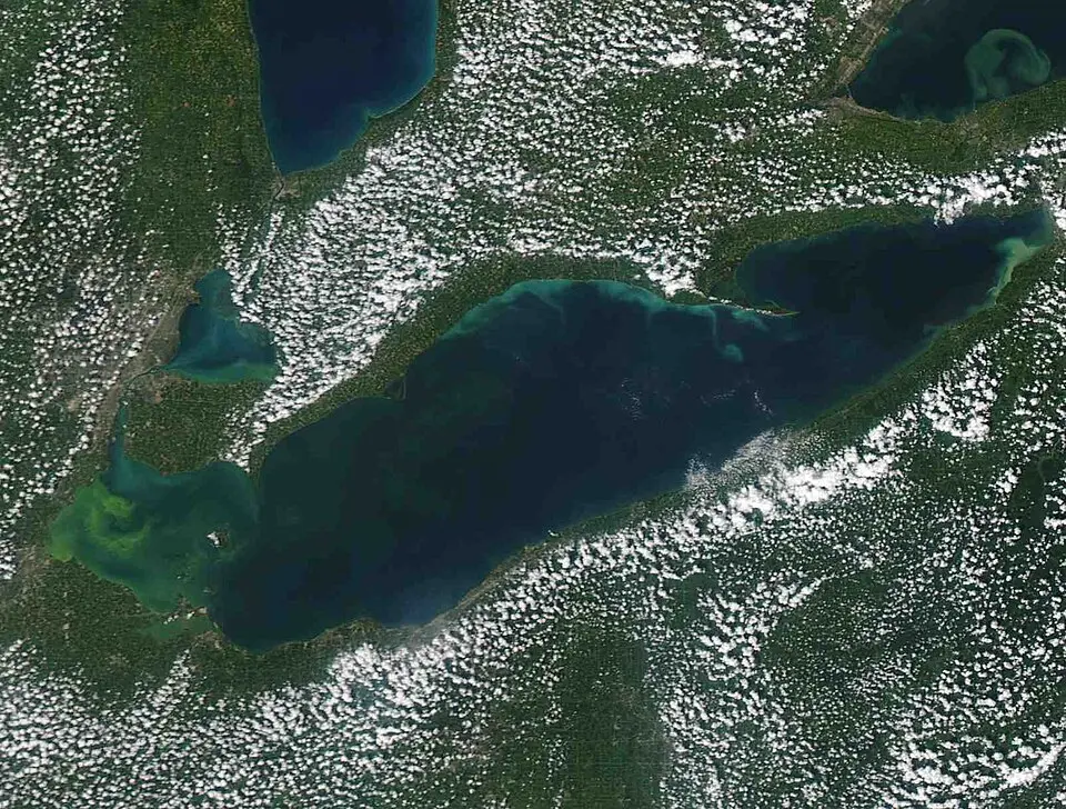
- Nutrient status. An oligotrophic lake is poor in nutrients, clear and rich in oxygen, while a eutrophic lake is rich in nutrients, green with plankton and short of oxygen at depth; the shift from one to the other is eutrophication.

The sea and the estuary
- Ocean zones. The intertidal zone lies between high and low tide, the neritic zone covers the continental shelf to a depth of about 200 metres, and the oceanic zone lies beyond. With depth, the sunlit epipelagic zone gives way to the twilight mesopelagic, the dark bathypelagic and abyssal zones, and the hadal zone of the trenches.
- Where the sea is rich. Most of the open ocean is poor in nutrients, but upwelling, where winds push surface water away and cold, nutrient rich water rises from below, supports large fisheries; off India's south west coast it peaks during the summer monsoon.
- Estuaries. An estuary is where a river meets the sea, so fresh and salt water mix and salinity changes with the tide and the season. Rivers bring nutrients, the tide traps them, and the shallow water is well lit, so estuaries are among the most productive ecosystems on Earth and serve as nurseries for fish and prawns; the Hooghly estuary and the Sundarbans delta are India's largest example.
Dimensions
- Ecological. Freshwater covers a tiny fraction of the Earth's surface yet holds a large share of its species, and coastal ecosystems such as estuaries and mangroves protect the land from storms and erosion.
- Economic. Inland and marine fisheries feed and employ millions of Indians, and estuaries and coastal lagoons are breeding and nursery grounds for many commercially caught fish and prawns.
- Health. Water with high biological oxygen demand (BOD), the oxygen that microbes need to decompose organic waste, is a sign of sewage, and the Central Pollution Control Board (CPCB) sets a dissolved oxygen of at least 5 milligrams per litre and a BOD of no more than 3 milligrams per litre for bathing water.
- Climate. The ocean absorbs much of the excess heat and carbon dioxide that humans add, but warmer water holds less oxygen, and the Arabian Sea already has one of the largest oxygen minimum zones in the world ocean.
In practice
- Chilika. Chilika in Odisha, India's largest brackish water lagoon, was among the first two Indian sites under the Ramsar Convention on Wetlands in 1981. Silting of its mouth reduced salt water exchange and choked it with weeds, so it was placed on the Montreux Record of threatened sites in 1993; after a new mouth was dredged in 2000, salinity and fish catch recovered and it was removed from the record in 2002.
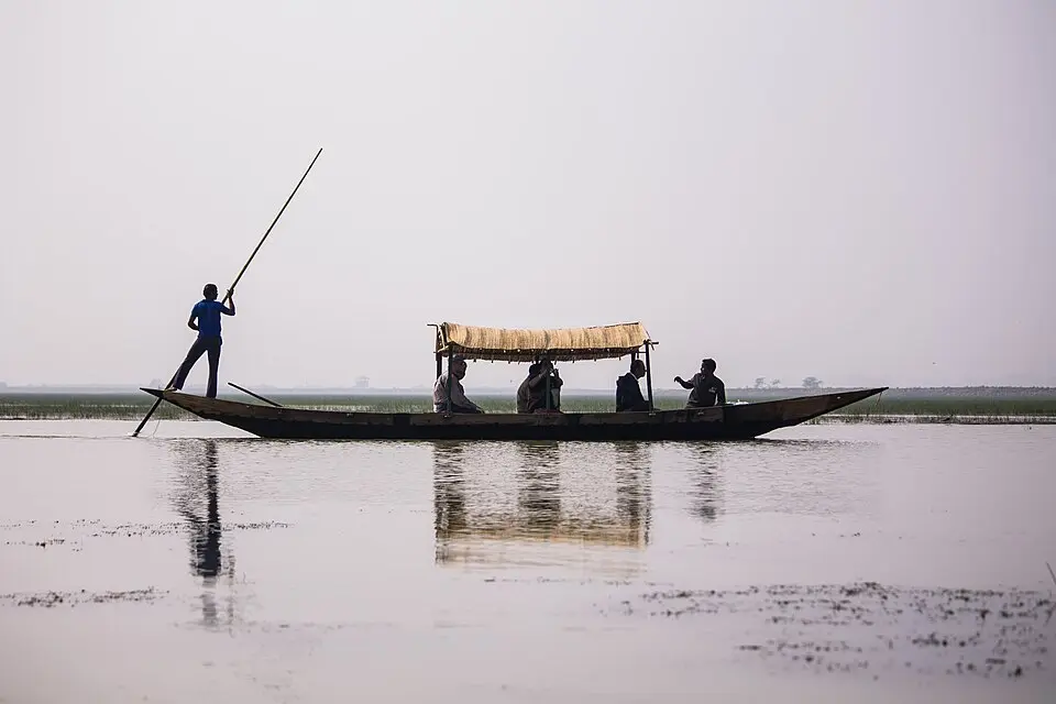
- Loktak. Loktak in Manipur, a freshwater lake, carries floating mats of vegetation and soil called phumdis, and on them lies Keibul Lamjao, the only floating national park in the world and the last home of the sangai, Rucervus eldii eldii, a subspecies of Eld's deer (Endangered as a species on the International Union for Conservation of Nature (IUCN) Red List, Schedule I of the Wildlife (Protection) Act 1972 as amended in 2022, and Appendix I of the Convention on International Trade in Endangered Species of Wild Fauna and Flora (CITES)). Hydropower regulation of the lake has thickened the phumdis, and Loktak has been on the Montreux Record since 1993.
- Urban lakes. Sewage has made many city lakes eutrophic, and Bellandur in Bengaluru has frothed with toxic foam and even caught fire, while Hussain Sagar in Hyderabad and Dal in Srinagar face weed growth and shrinking open water.
- The legal and programme frame. The Water (Prevention and Control of Pollution) Act 1974 created the pollution control boards, the National Plan for Conservation of Aquatic Ecosystems (NPCA) of 2013 merged the National Lake Conservation Plan and the National Wetlands Conservation Programme under the Ministry of Environment, Forest and Climate Change, and the Wetlands (Conservation and Management) Rules 2017 regulate activities in notified wetlands.

Issues and way forward
- Sewage and fertiliser feed eutrophication. Untreated urban sewage and runoff from fields carry nitrogen and phosphorus into lakes and estuaries, so treating sewage before it reaches water, reusing treated water and cutting fertiliser losses address the cause rather than the weeds.
- Lakes are encroached and filled. Lake beds and their catchments are built over because their boundaries are not mapped or notified, so notifying wetlands under the 2017 Rules, protecting catchments and keeping inflow channels open are the first steps.
- Estuaries lose fresh water. Dams and diversions upstream reduce river flow, so salt water moves inland and the mix that makes an estuary productive is lost; minimum environmental flows in rivers protect the estuary as well as the river.
- Warming and oxygen loss. Warmer water holds less oxygen and stratifies more strongly, which expands oxygen poor zones and harms fisheries, so cutting nutrient loads, which also deplete oxygen, gives coastal ecosystems more room to cope with warming.
- Weak monitoring. Many water bodies are measured rarely and only for a few indicators, so regular monitoring of dissolved oxygen, nutrients and plankton, with data made public, would show trouble before a fish kill does.
Common confusions
- Lentic and lotic. Lentic water is standing water, such as a lake or pond, while lotic water is running water, such as a river or stream.
- Plankton and nekton. Plankton drift with the current and cannot swim against it, while nekton, such as fish, swim freely.
- Estuary and lagoon. An estuary is the mouth of a river where fresh and salt water mix, while a lagoon is a shallow coastal water body separated from the sea by a sandbar or barrier, as Chilika and Pulicat are; a lagoon can be brackish without being a river mouth.
- BOD and DO. Dissolved oxygen is the oxygen present in water, while biological oxygen demand is the oxygen microbes would need to break down the organic matter in it, so clean water has high DO and low BOD.
- Thermocline and photic zone. The thermocline is a layer defined by a sharp change in temperature, while the photic zone is defined by light; they often lie at different depths.
For the exam
- Keyword bank: lentic and lotic, littoral, limnetic and profundal zones, thermal stratification, thermocline, lake overturn, photic zone, plankton, estuary, brackish water, upwelling, oligotrophic and eutrophic, cultural eutrophication, dissolved oxygen, biological oxygen demand.
- Previous year questions: Practise the previous year questions on this topic →
- Use in an answer:
- Introduction with data: Microscopic phytoplankton carry out about half of the photosynthesis on Earth, which makes the sunlit top layer of the ocean as important to the planet's oxygen and carbon as all its forests.
- Introduction with a record: Chilika, placed on the Ramsar Convention's Montreux Record in 1993 and removed in 2002 after its sea mouth was reopened, shows that a degraded aquatic ecosystem can recover when its water flows are restored.
- Conclusion: Aquatic ecosystems fail first through their oxygen, so keeping nutrients and sewage out of water is the single most effective way to protect lakes, rivers and estuaries.
- Conclusion: Managing a water body means managing its catchment and its flows, because what happens upstream and on the land decides what lives in the water.