Fragile ecosystems: mountains, grasslands, deserts and islands
- Syllabus
- Conservation, environmental pollution and degradation, environmental impact assessment
- As of
- October 2026
- fragile ecosystem
- resilience
- ecologically sensitive area
- eco sensitive zone
- Western Ghats Ecology Expert Panel
- Kasturirangan High Level Working Group
- natural and cultural landscape
- carrying capacity
- Indian Himalayan Region
- Bhagirathi eco sensitive zone
- shola grassland
- open natural ecosystems
- cold desert
- island endemism
- Great Nicobar project
The first principle
An ecosystem is fragile when a small disturbance causes a large change and recovery is slow or never comes. Fragility follows from two properties: low resilience, because soil, water or productivity is scarce, and high irreplaceability, because the species there live nowhere else. Steep young mountains, monsoon soaked escarpments, grasslands, deserts and small islands share these properties, so the same road, dam or plantation that a plain can absorb can unravel them. Protecting them is therefore a matter of location: the question is not whether to develop, but where and how much.
The core
What makes an ecosystem fragile
- Low resilience. Resilience is the ability of a system to return to its earlier state after a shock, and it depends on how fast soil forms, water returns and plants regrow. In a cold desert plants grow for a few weeks a year and a centimetre of soil takes centuries to form, so a scar from a vehicle track can last for decades.
- Thresholds. Many fragile systems change abruptly once a limit is crossed: a slope holds until the toe is cut and saturated, and then it fails all at once; a grassland heavily grazed for years tips into scrub. Such shifts are hard to reverse because the new state sustains itself.
- Endemism and small ranges. Species confined to a mountain top, a single island or a patch of grassland have nowhere to retreat, so losing a small area can mean losing a whole species. This is why the Western Ghats, with its high share of endemic amphibians, fish and plants, is part of a global biodiversity hotspot.
- Service to people far away. Fragile uplands are water towers: the Himalaya feeds the Indus, Ganga and Brahmaputra, and the Western Ghats feed the Godavari, Krishna and Kaveri, so damage at the source is paid for downstream.
The legal tools
- Ecologically sensitive area (ESA). Section 3(2)(v) of the Environment (Protection) Act 1986, read with Rule 5 of the Environment (Protection) Rules, lets the Centre restrict industries and processes in any area. This power produced the early area notifications for the Doon Valley (1989), Dahanu (1991) and the Aravalli hills (1992), and the Pronab Sen Committee (2000) set out criteria such as endemism, slope and the presence of rare species for choosing such areas.
- Eco sensitive zone (ESZ). An ESZ is a buffer notified under the same power around a national park or sanctuary, with activities graded as prohibited, regulated or permitted. The familiar 10 km figure comes from the Wildlife Conservation Strategy 2002 and the 2011 guidelines, not from the Act. The Supreme Court ordered a uniform minimum ESZ of 1 km on 3 June 2022 and relaxed it on 26 April 2023, keeping the ban on mining inside and near protected areas.
Dimensions
- Ecological. These systems hold a large share of India's endemic species and regulate water, so their loss is both a biodiversity loss and a hydrological one.
- Economic. Hill economies depend on tourism, plantations, hydropower and roads, and each of these competes for the same unstable slopes; an ESA notification therefore reads, to a farmer or a quarry owner, as a cut in income.
- Social and federal. People who live in the Western Ghats, the Himalaya or the Nicobar islands rarely chose the boundaries drawn around them, and land is a State subject, so States have resisted Central notifications that freeze land use.
- Disaster. Landslides, flash floods and land subsidence are often triggered by construction on fragile slopes; the hazards themselves are covered in the Disaster Management notes, but the cause lies in land use.
- Climate. Glaciers, grasslands and island coasts are among the first systems to change with warming, and degraded systems have less capacity to adapt.
In practice
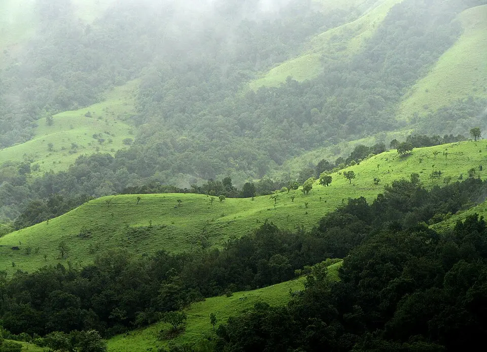
The Western Ghats debate
- The Gadgil report (2011). The Western Ghats Ecology Expert Panel (WGEEP), chaired by Madhav Gadgil, treated the whole of the Western Ghats as ecologically sensitive and graded it into three zones by sensitivity, with the strictest limits on mining, new dams and land conversion in the first zone. It proposed a Western Ghats Ecology Authority and wanted gram sabhas to have a central role in deciding what is allowed.
- The Kasturirangan report (2013). The High Level Working Group (HLWG), chaired by K Kasturirangan, divided the Ghats into a cultural landscape of settlements, farms and plantations and a natural landscape, and recommended that about 37 per cent of the Ghats, roughly 60,000 sq km, be notified as ESA. Within the ESA it proposed a ban on mining and quarrying, red category industries including thermal power plants, and large buildings and townships.
- Where it stands. The Ministry of Environment, Forest and Climate Change (MoEFCC) has issued and reissued draft ESA notifications based on the Kasturirangan report since 2014, the latest proposing about 56,800 sq km across Gujarat, Maharashtra, Goa, Karnataka, Kerala and Tamil Nadu, but no final notification has been issued because States want villages and plantations taken out.

The Himalaya
- A young, rising range. The Himalaya is still rising, is seismically active and has steep slopes of weak rock, so cutting a road or tunnel can destabilise a whole hillside. The land subsidence at Joshimath in January 2023 showed how unplanned building, poor drainage and large projects on old landslide debris combine.
- Responses. The National Mission for Sustaining the Himalayan Ecosystem is one of the eight missions of the National Action Plan on Climate Change (NAPCC) of 2008. The Bhagirathi ESZ, notified in 2012, covers about 100 km of the river from Gaumukh to Uttarkashi, and the Supreme Court has since pressed the Centre to study the carrying capacity of Himalayan towns.
Grasslands, deserts and islands
- Grasslands. Shola grasslands, the Banni of Kutch, the terai grasslands and the semi arid grasslands of the Deccan support the great Indian bustard, the blackbuck and the wolf. Revenue records have long classed them as wasteland, so they are handed over for plantations, solar parks and industry, and invasive Prosopis juliflora has spread over much of the Banni.
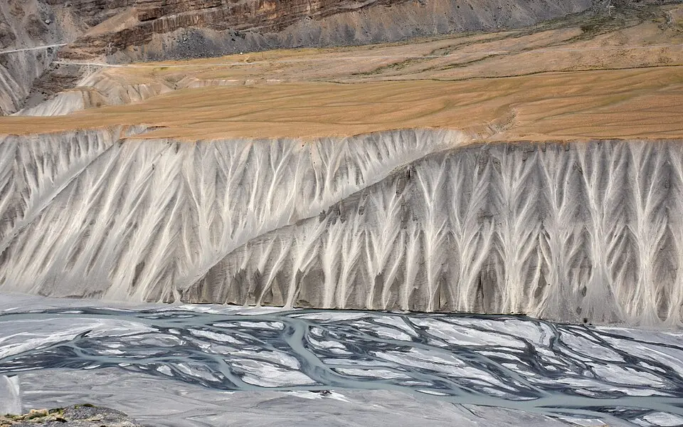
- Deserts. The Thar is a hot desert whose shrubs, grasses and oran groves support life on very little water, and the Desert National Park protects part of it. The cold deserts of Ladakh and Lahaul and Spiti get little rain or snow and have a short growing season; the Cold Desert Biosphere Reserve in Himachal Pradesh joined the World Network of Biosphere Reserves of the United Nations Educational, Scientific and Cultural Organization (UNESCO) in September 2025.
- Islands. Small islands have high endemism and little room to absorb change. The Great Nicobar project, a port, airport and township on the island's south, would divert about 130 sq km of forest, and critics point to the leatherback turtle nesting beaches of Galathea Bay and the rights of the Shompen, a particularly vulnerable tribal group.

Issues and way forward
- Notification without final decision. Repeated drafts for the Western Ghats leave both conservation and development uncertain; a final notification that removes genuine settlements but keeps the ban on mining and quarrying in the natural landscape would end the drift.
- Top down boundaries. ESAs drawn on maps in Delhi provoke resistance, which is why the Gadgil panel wanted gram sabhas to decide zoning; involving local bodies through Biodiversity Management Committees and people's biodiversity registers builds consent.
- Project by project clearance. Each road, dam or tunnel is cleared on its own, so their combined effect on a valley is never assessed; cumulative impact assessment and carrying capacity studies for Himalayan towns and river basins are the remedy.
- Grasslands treated as waste. As long as revenue records call open grasslands wasteland, they will be planted with trees or given to industry; recognising open natural ecosystems as a land category of their own is the needed reform.
- Weak enforcement on the ground. Quarries and resorts operate inside proposed zones; satellite monitoring and penalties under the Environment (Protection) Act give the rules teeth.
Common confusions
- ESA and ESZ. An ESA is a large landscape, such as the Western Ghats, chosen for its own sensitivity, while an ESZ is a buffer around one national park or sanctuary; both are notified under Section 3(2)(v) of the Environment (Protection) Act.
- ESZ and the buffer of a tiger reserve. An ESZ is a notification under the Environment (Protection) Act, while a buffer zone is part of a tiger reserve under the Wildlife (Protection) Act.
- Gadgil and Kasturirangan. Gadgil treated the whole range as sensitive and graded it, while Kasturirangan protected only the natural landscape, about 37 per cent of the area, but strictly.
- Desert and degraded land. A desert is a natural ecosystem with its own species, while desertification is the degradation of drylands by people and climate; the land degradation note carries the second.
For the exam
- Keyword bank: fragility and resilience, ecological threshold, endemism, water tower, ecologically sensitive area, eco sensitive zone, natural and cultural landscape, gram sabha led zoning, carrying capacity, cumulative impact assessment, open natural ecosystems, island endemism, Bhagirathi eco sensitive zone, Cold Desert Biosphere Reserve.
- Previous year questions: Practise the previous year questions on this topic →
- Use in an answer:
- Introduction with data: The Kasturirangan group proposed that about 37 per cent of the Western Ghats, roughly 60,000 sq km, be notified as ecologically sensitive, yet more than a decade later the notification is still only a draft.
- Introduction with a report: The Western Ghats Ecology Expert Panel of 2011 argued that the whole range is ecologically sensitive and that the people who live there, through their gram sabhas, should decide what is allowed.
- Conclusion: Fragile ecosystems cannot be protected project by project; they need landscape level zoning, cumulative assessment and the consent of the people who live in them.
- Conclusion: The cheapest disaster management in the hills is to decide where not to build, and the Western Ghats and Himalayan debates are really about that decision.