Land degradation and desertification
- Syllabus
- Conservation, environmental pollution and degradation, environmental impact assessment
- As of
- October 2026
- land degradation
- desertification
- drylands
- aridity index
- soil erosion
- salinisation
- vegetation degradation
- Desertification and Land Degradation Atlas
- UNCCD
- land degradation neutrality
- SDG target 15.3
- Bonn Challenge
- 26 million hectares
- watershed development
- Riyadh Global Drought Resilience Partnership
The first principle
Soil is the thin, living skin of the land, and it forms far more slowly than it can be lost: the Food and Agriculture Organization estimates that a centimetre of topsoil can take up to a thousand years to form, while a single season of bad farming or heavy rain on bare ground can strip it away. Land degrades whenever we take more from it, in crops, grazing, wood or water, than its natural processes can replace. In dry regions, where rain is scarce and plants recover slowly, that loss can push land past a point from which it does not recover on its own, and this is what desertification means.
The core
What the terms mean
- Land degradation is the reduction or loss of the biological or economic productivity of land, through erosion, loss of soil nutrients and organic matter, salinity, waterlogging or the loss of natural vegetation. It can happen anywhere.
- Desertification is land degradation in drylands, meaning arid, semi arid and dry sub humid areas, caused by climatic variations and human activities. It is not the advance of sand dunes from an existing desert, but the decline of land that was productive.
- Drylands are defined by the aridity index, the ratio of annual rainfall to potential evapotranspiration (the water that would evaporate and transpire if it were available). Areas with a ratio between 0.05 and 0.65 count as drylands, and they cover a large part of India, from the Thar to the rain shadow regions of the Deccan.
How land degrades
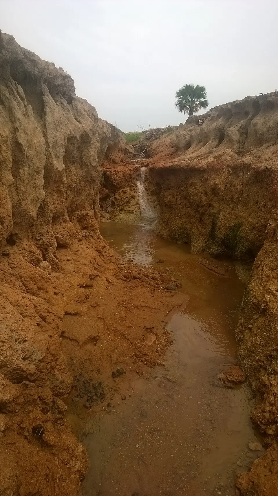
- Water erosion is the most widespread process in India: rain falling on bare or sloping ground washes away topsoil as sheets, rills and gullies, and in the Chambal and Yamuna valleys deep ravines have cut through farmland.
- Wind erosion lifts dry, loose soil where vegetation is thin, as in western Rajasthan and parts of Gujarat, and buries fields and roads in sand.
- Vegetation degradation is the thinning of forests, scrub and grasslands by overgrazing, fuelwood cutting and shifting cultivation on shortened cycles, which leaves the soil exposed.
- Salinisation and waterlogging follow when canal irrigation without drainage raises the water table, so that water evaporates at the surface and leaves salt behind, as in parts of the Indira Gandhi Canal command and Punjab and Haryana.
- Other drivers include mining, which strips topsoil and leaves waste dumps, the spread of towns over farmland, and unbalanced use of fertiliser that runs down soil nutrients and organic matter.
Dimensions
- Agricultural and economic. Degraded land yields less, needs more fertiliser and water, and lowers farm incomes, which hits rainfed farmers in drylands hardest.
- Water. Bare land lets rain run off rather than recharge aquifers, silts up reservoirs and makes both floods and droughts worse, which is why land and water conservation are one task.
- Climate. Soils hold more carbon than the atmosphere and all vegetation together, so degraded soils release carbon dioxide, while restored land can store it, and a warmer climate in turn speeds up drying and erosion.
- Biodiversity. The loss of grasslands and scrub destroys the habitat of species such as the Great Indian Bustard, and degraded land is easily taken over by invasive plants such as Prosopis juliflora.
- Social. Pastoralists, tribal communities and smallholders depend most on common lands, which are often the most degraded, and land loss pushes people to migrate.
- Security. Globally, the convention secretariat links drought and land loss to food insecurity, displacement and conflict, especially in the Sahel.
In practice
Measuring it: the Atlas
- The Desertification and Land Degradation Atlas of India, prepared by the Space Applications Centre (SAC) of the Indian Space Research Organisation (ISRO) from satellite data and published in 2021, found 97.85 million hectares, about 29.7 per cent of India's geographical area of 328.72 million hectares, under degradation in 2018-19. The figure was 94.53 million hectares (28.76 per cent) in 2003-05 and 96.40 million hectares (29.32 per cent) in 2011-13, so degradation is still rising slowly.
- Desertification, degradation within drylands, covered 83.69 million hectares in 2018-19.
- By process, water erosion affected about 11 per cent of the country, vegetation degradation about 9.15 per cent and wind erosion about 5.46 per cent.
- By State, Rajasthan, Maharashtra, Gujarat, Karnataka, Ladakh, Jharkhand, Odisha, Madhya Pradesh and Telangana together account for most of the degraded area.

The convention and the targets
- The United Nations Convention to Combat Desertification (UNCCD) was adopted in Paris in 1994 and came into force in 1996, the third of the Rio conventions alongside those on climate and biodiversity. It has 197 parties, its secretariat is in Bonn, and India is a party.
- Land degradation neutrality (LDN) is a state in which the amount and quality of healthy land stays stable or increases, so that new degradation is balanced by restoration. It is Sustainable Development Goal (SDG) target 15.3, which asks the world to strive for a land degradation neutral world by 2030.
- India's target. At the fourteenth conference of the parties (COP14), hosted by India in New Delhi in September 2019, India raised its target to restore 26 million hectares of degraded land by 2030, which also serves as its pledge under the Bonn Challenge, a global effort to bring degraded and deforested land under restoration. COP14 adopted the New Delhi Declaration, and India announced a centre of excellence on sustainable land management at the Indian Council of Forestry Research and Education in Dehradun.
- COP16 at Riyadh (December 2024), the first held in the Middle East, adopted 39 decisions and saw pledges of about 12.15 billion US dollars to the Riyadh Global Drought Resilience Partnership, but parties could not agree on a global drought regime and deferred it.
- COP17 at Ulaanbaatar (August 2026), held in the International Year of Rangelands and Pastoralists, took up the drought question deferred at Riyadh, the convention's strategy beyond 2030 and the restoration of rangelands.
India's programmes
- Watershed development, treating a whole catchment from ridge to valley with bunds, trenches, check dams and plantations so that rain is held where it falls, is run by the Department of Land Resources as the watershed component of the Pradhan Mantri Krishi Sinchayee Yojana (PMKSY), now in a second phase.
- The Aravalli Green Wall Project, launched in March 2023, aims to green a five kilometre buffer around the Aravalli hills across Gujarat, Rajasthan, Haryana and Delhi, to stop the eastward spread of degradation from the Thar.
- Soil Health Cards, issued to farmers since 2015, guide balanced use of fertiliser, and the Green India Mission restores forest and tree cover, as the forests note explains.
Issues and way forward
- Common lands have no owner. Village pastures and wastelands are overgrazed because no one is responsible for them, so community management with clear rights, as under joint forest management and the Forest Rights Act, is needed.
- Irrigation without drainage. Canal commands suffer salinity and waterlogging, so drainage, lining of canals and conjunctive use of surface and groundwater should be part of every project.
- Plantations counted as restoration. Planting single species on grasslands or on land that was never forest can harm native ecosystems, so restoration targets should measure soil and ecosystem health, not only trees planted.
- Weak monitoring. The Atlas is updated only every few years and progress on the 26 million hectare target is hard to verify, so a regular, public land accounting system is needed.
- Fertiliser imbalance. Subsidies make urea far cheaper than other nutrients, so farmers overuse nitrogen and soil health declines; balanced nutrition, organic manure and natural farming practices deserve support.
- The response hierarchy. The UNCCD's scientific framework for LDN ranks responses as avoid, then reduce, then reverse degradation, because preventing damage is far cheaper than repairing it.
Common confusions
- Desertification and the spread of deserts. Desertification is the degradation of productive dryland, not the movement of dunes from an existing desert into new areas.
- Land degradation and desertification. Land degradation can occur in any climate, while desertification is land degradation confined to drylands.
- Land degradation neutrality and zero degradation. Neutrality allows some land to degrade as long as an equal area of similar land is restored, while zero degradation would mean none is lost.
- The Bonn Challenge and LDN. The Bonn Challenge is a voluntary global restoration pledge launched in 2011, while LDN is a target under the UNCCD and the SDGs; India uses the same 26 million hectare figure for both.
For the exam
- Keyword bank: land degradation, desertification, drylands, aridity index, water erosion, wind erosion, salinisation, vegetation degradation, Desertification and Land Degradation Atlas, UNCCD, land degradation neutrality, SDG target 15.3, Bonn Challenge, watershed development, avoid reduce reverse.
- Previous year questions: Practise the previous year questions on this topic →
- Use in an answer:
- Introduction with data: About 97.85 million hectares, nearly 30 per cent of India's land, was under degradation in 2018-19, up from 94.53 million hectares in 2003-05 (SAC, ISRO, 2021).
- Introduction with an agreement: At COP14 of the UNCCD in New Delhi in 2019, India committed to restore 26 million hectares of degraded land by 2030 as its contribution to land degradation neutrality.
- Conclusion: Land degradation neutrality is a balance, not a ban, so India must both avoid new degradation and restore old, with watershed treatment on rainfed farms reaching the most land at the least cost.
- Conclusion: Because soil forms over centuries and is lost in seasons, protecting land is a long term investment in food, water and climate security.